Before planning any visit, read your government's current travel advice for Myanmar. Since the military takeover in 2021, the country has been affected by armed conflict and political unrest, and many governments advise against all or most travel there. Conditions can change quickly. This sheet describes the downtown area as a historic townscape; whether it is sensible to go is a decision to make with up-to-date official information.
Downtown Yangon is the old commercial heart of what was once the capital of Burma. After taking the city in 1852, the British laid out a grid of streets on the low land beside the Yangon River, with the Sule Pagoda at its centre. They filled the grid with offices, banks, courts, churches and shophouses, and for decades the city was one of the busiest ports in Asia. Today many of those buildings still stand, some restored and many crumbling, giving downtown a character unlike anywhere else in the region.
Sule Pagoda at the centre
The Sule Pagoda is the fixed point around which the grid was planned. Its golden stupa rises from the middle of a busy roundabout, surrounded by small shops built into its base. Local tradition holds that it is more than two thousand years old and enshrines a hair of the Buddha. Visitors can enter by stairways from the street; shoes and socks must be removed at the entrance, so wear sandals.
From the pagoda, the main roads run in straight lines: Sule Pagoda Road north and south, Maha Bandula Road east and west. Smaller numbered streets cross the long east-west roads at regular intervals, which makes the area easy to navigate once you understand the pattern.
i
City Hall and Maha Bandula Park
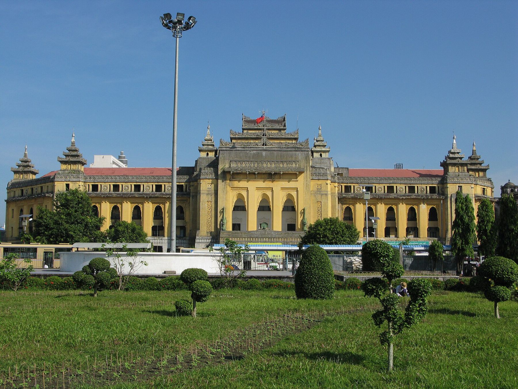
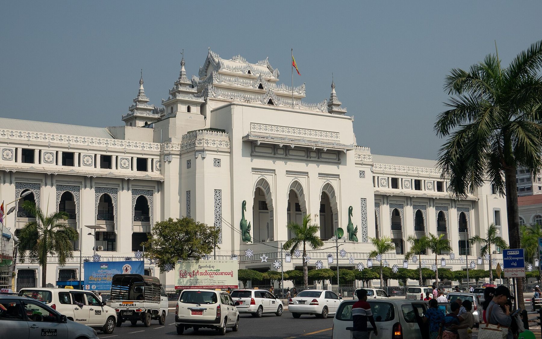
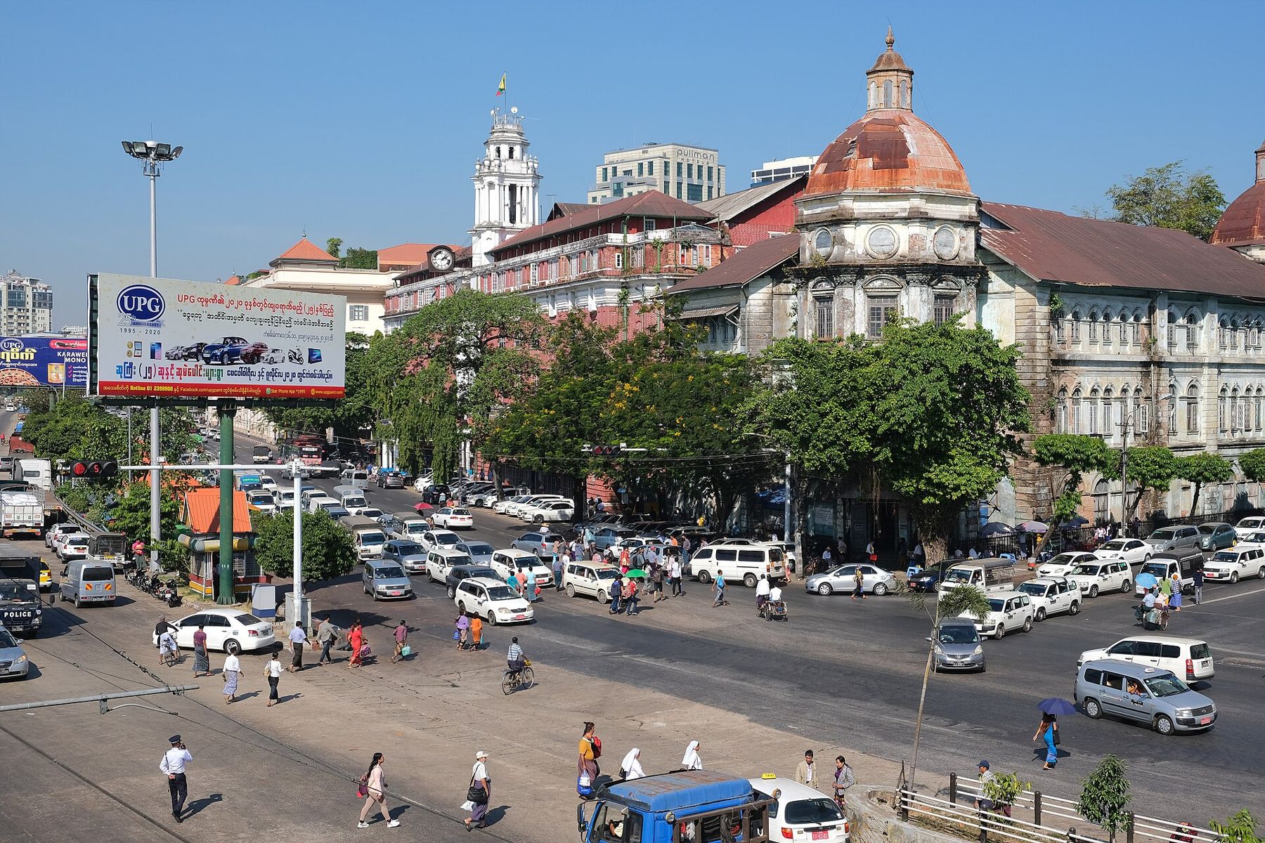
Beside the pagoda stands City Hall, built in the 1930s in a style that mixes colonial architecture with Burmese elements, such as tiered roofs and peacock motifs. Across the road, Maha Bandula Park is an open green space with the Independence Monument, a white obelisk, at its centre. Around the park stand several of the grandest colonial buildings in the city, including the red-brick former High Court with its clock tower.
The park is a good place to sit in the shade early in the morning and watch the city wake up, with people exercising, vendors setting up and monks crossing the paths.

i
Pansodan Street
East of the park, Pansodan Street runs south towards the river through the old banking and business district. It is lined with large colonial office buildings, some with grand stone facades, columns and domes. On the pavements, booksellers lay out old books, magazines and maps, and the street has long been the centre of Yangon's second-hand book trade.
Many of the buildings here are in poor repair, with plants growing from cracks and walls blackened by monsoon rains. Some have been restored, and heritage groups have campaigned to protect them. Walking along Pansodan is a lesson in how a colonial city ages.
At the southern end of Pansodan Street, Strand Road runs along the riverfront. The Strand was once lined with the offices of shipping companies and port authorities, and some of those buildings remain. The river itself is wide and brown, busy with ferries and cargo boats. A short ferry ride crosses it to the township of Dala on the far bank, a glimpse of rural life just minutes from the city.
North-east of the park stands the Secretariat, a vast red-brick complex built in the late nineteenth and early twentieth centuries as the seat of the colonial government. In 1947 the independence leader Aung San and several members of his cabinet were assassinated in this building, months before Burma became independent. It has been partly restored, and access to it varies.
The streets around it hold other reminders of the city's mixed past, including St Mary's Cathedral, a Hindu temple and an old synagogue that served a once-thriving Jewish community.
Walking along Pansodan is a lesson in how a colonial city ages.
Fold over to C3Rattanakosin island, temple to temple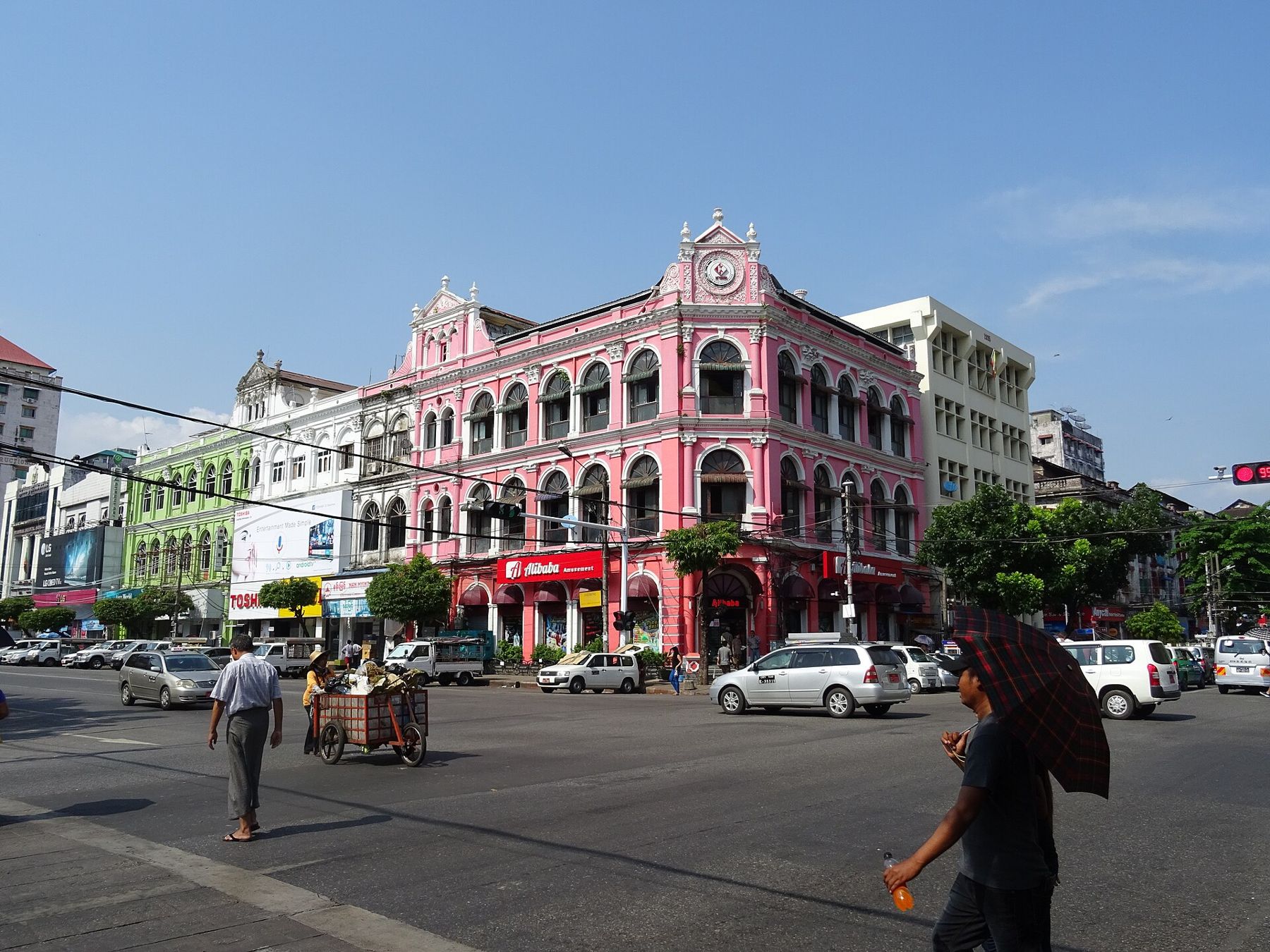
i
Reading the streets
The east-west roads, such as Anawrahta, Maha Bandula and Merchant Road, run the full width of downtown, while the shorter north-south streets are mostly numbered rather than named. Each block has its own character. Some streets are known for particular trades, from printing presses to spare parts, and the ground floors of the old buildings are packed with small businesses. Above them, the upper floors are often homes, with washing hung from the balconies.
The population of downtown has always been mixed. Indian, Chinese, Burmese and other communities lived and traded here side by side, and the streets still show it, with mosques, Hindu temples, Chinese clan halls and churches within a few blocks of each other. Around the eastern streets, the Chinese quarter has its own markets and temples, and the western side holds many of the older Indian businesses and mosques.
Heritage under pressure
Yangon has one of the largest collections of colonial-era buildings in South-East Asia, partly because decades of isolation and slow development left them standing when other cities in the region tore theirs down. Many are now under threat from decay, neglect and redevelopment. Heritage groups have listed hundreds of important buildings, and some have been carefully restored as offices, galleries and hotels, but many more are in poor condition.
When you walk downtown, you see both sides: grand restored facades next to buildings with collapsing roofs and trees growing from their walls. Photographs of the decaying buildings are popular, but remember that people live and work in many of them.
i
The riverside at the southern end of downtown has changed more than the grid behind it. Wharves and jetties line the bank, and ferries shuttle across the wide brown water to Dala all day, packed with commuters, vendors and bicycles. The crossing is short, and the view back to the city skyline from the water shows how low and spread out the colonial city still is, with only a few towers rising above the old roofs and the gold of the pagodas catching the sun.
Timing and practical points
Sunday mornings are the best time to walk downtown, when traffic is light and the streets are quiet. Start early, before the heat, and finish by late morning. The pavements are uneven and often broken, with open drains and stalls in the way, so watch your step. The great Shwedagon Pagoda lies a few kilometres north of downtown and is a separate visit. Again: check current travel advice and local conditions before you go. Other colonial-era grids worth comparing are in Kuala Lumpur and Manila.