Vientiane is one of the quietest capitals in Asia. It sits on a long bend of the Mekong, with Thailand on the far bank, and its centre is a compact area of temples, French colonial buildings and low shophouses along a handful of wide streets. Traffic is light by regional standards, and the pace is unhurried.
This sheet covers the centre on foot, from a black stupa in a traffic island to the riverfront, with two old temples and a ceremonial gate along the way.
That Dam, the black stupa
Start at That Dam, a stupa of dark, weathered brick standing in a small roundabout a few streets back from the river. It is thought to date from the time of the Lan Xang kingdom, and it has lost whatever covering it once had, leaving a rough, mossy cone of brick. A local legend says that a seven-headed serpent, a naga, lived inside it and protected the city from invaders.
The streets around That Dam are some of the most pleasant in the city, with old villas and quiet lanes. Walk west and south towards the presidential palace.
i
Wat Si Saket
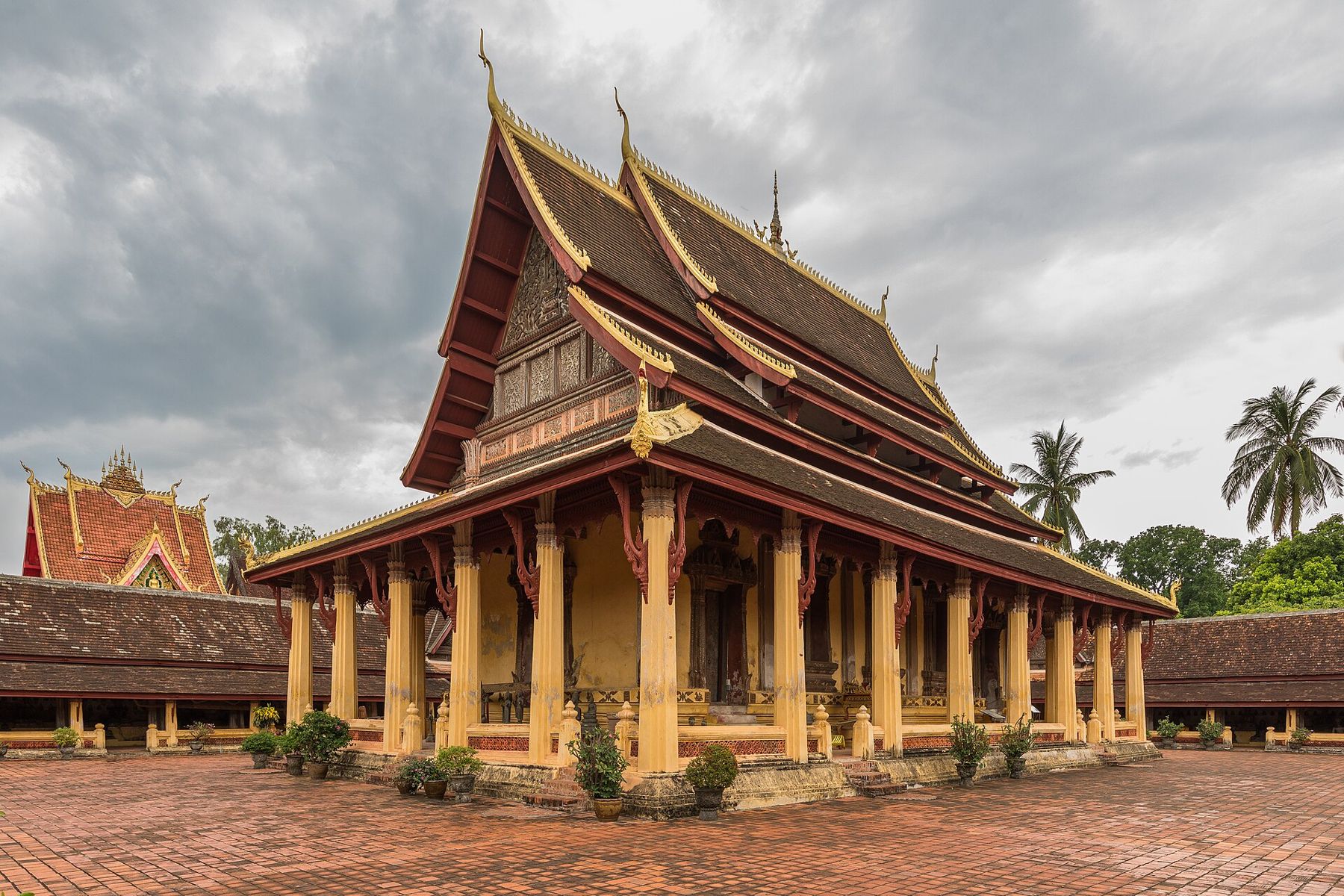
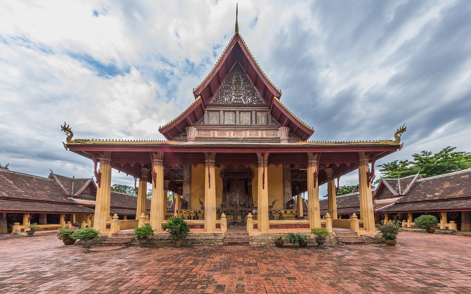
Opposite the presidential palace stands Wat Si Saket, built in the early nineteenth century. It is the oldest surviving temple in Vientiane, because it was spared when the city was sacked by a Siamese army in 1827-28. Its cloister walls are lined with thousands of small Buddha images, set in niches in rows, along with larger seated Buddhas on shelves below.
The main hall has a five-tiered roof and faded murals inside. The atmosphere is calm and old, and the temple is now a museum as well as a place of worship. There is a small entry fee, and visitors should dress modestly.
Across the road from Wat Si Saket, Haw Phra Kaew was built in the sixteenth century as the royal temple to house the Emerald Buddha, a revered jade image. In the late eighteenth century, a Siamese army took the image to Bangkok, where it remains. The temple was destroyed and later rebuilt, and today it is a museum of religious art, with Buddha images and carvings displayed on its terraces and in its hall.
Fold over to C2The peninsula between two riversTo the Mekong
From the temples, walk south a few blocks to the Mekong. The riverfront has been rebuilt with a long promenade and a park, with a statue of a former king facing towards Thailand. The river here is broad, and in the dry season its level drops to reveal wide sandbanks.
In the evening, the promenade fills with people exercising, walking and eating, and a night market sets up along part of it, with stalls selling clothes and goods. Sunset over the river is the moment to be here, when the sky over the Thai bank turns orange and the heat of the day eases.
Lane Xang Avenue and the Patuxai
Lane Xang Avenue, the city's main boulevard, runs north-east from the presidential palace to the Patuxai, a large monumental gate. Built in the 1960s, it resembles the Arc de Triomphe in Paris but is decorated with Lao motifs, including carved figures from Buddhist and Hindu legends. A well-known story says it was built with cement given by the United States for an airport runway, earning it the nickname the vertical runway.
Visitors can climb the stairs inside the Patuxai to viewing platforms at the top, for a fee. The view down Lane Xang Avenue and over the low city is the best way to understand its layout. The park around the gate has fountains and gardens.
A morning market and the old shophouse streets
Between the temples and the river, the streets around Nam Phu, a fountain square, hold most of the old French-era buildings in the centre, many now restored as offices, shops and cafes. A little to the east, the shophouse streets of the old commercial quarter have Chinese and Vietnamese temples tucked between them, a reminder of the trading communities that settled here in the colonial period.
The city's morning market, a large covered market a short walk from the centre, is the place to see everyday Vientiane: stalls selling fabric, household goods, gold and electronics, with food stalls around the edges. It is busy from early morning and quieter by early afternoon.
Further out: Pha That Luang
About two kilometres north-east of the Patuxai stands Pha That Luang, a large golden stupa that is the national symbol of Laos. It is a long walk in the heat, so most people take a taxi or tuk-tuk. A temple festival is held there in November, drawing crowds from across the country, with processions, offerings and a large fair around the stupa. The stupa's golden spire, rising from a square base surrounded by cloisters, appears on the national seal and on banknotes.
Along the way, small noodle shops and coffee stalls open early for workers and monks, and the smell of baguettes, a legacy of the French period, drifts from bakeries in the centre. Stop for a while: in Vientiane, sitting still is part of the visit.
Morning first, river at sunset
The central walk is best done in the morning, with the riverfront saved for sunset. The heat from March to May is intense, and the town slows down in the middle of the day. Vientiane is linked by railway with Luang Prabang and by the Friendship Bridge with Nong Khai in Thailand; from there, trains run south towards Bangkok. Opening hours and entry fees change, so check them for Vientiane before you go.