Luang Prabang was the royal capital of Laos for centuries, and its old town sits on a narrow peninsula where the Nam Khan river flows into the Mekong. Within this small area stand more than thirty Buddhist temples, wooden Lao houses on stilts and two-storey villas from the French colonial period, all under a green canopy of palms and tamarind trees. UNESCO listed the town as a World Heritage Site in 1995, and strict rules have kept new building low and in keeping with the old.
The peninsula is small enough to walk from one end to the other in half an hour. Doing it properly, with stops in the temples and along the riverbanks, takes much longer.
Wat Xieng Thong at the tip
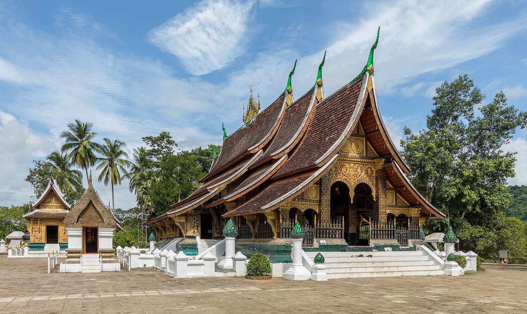
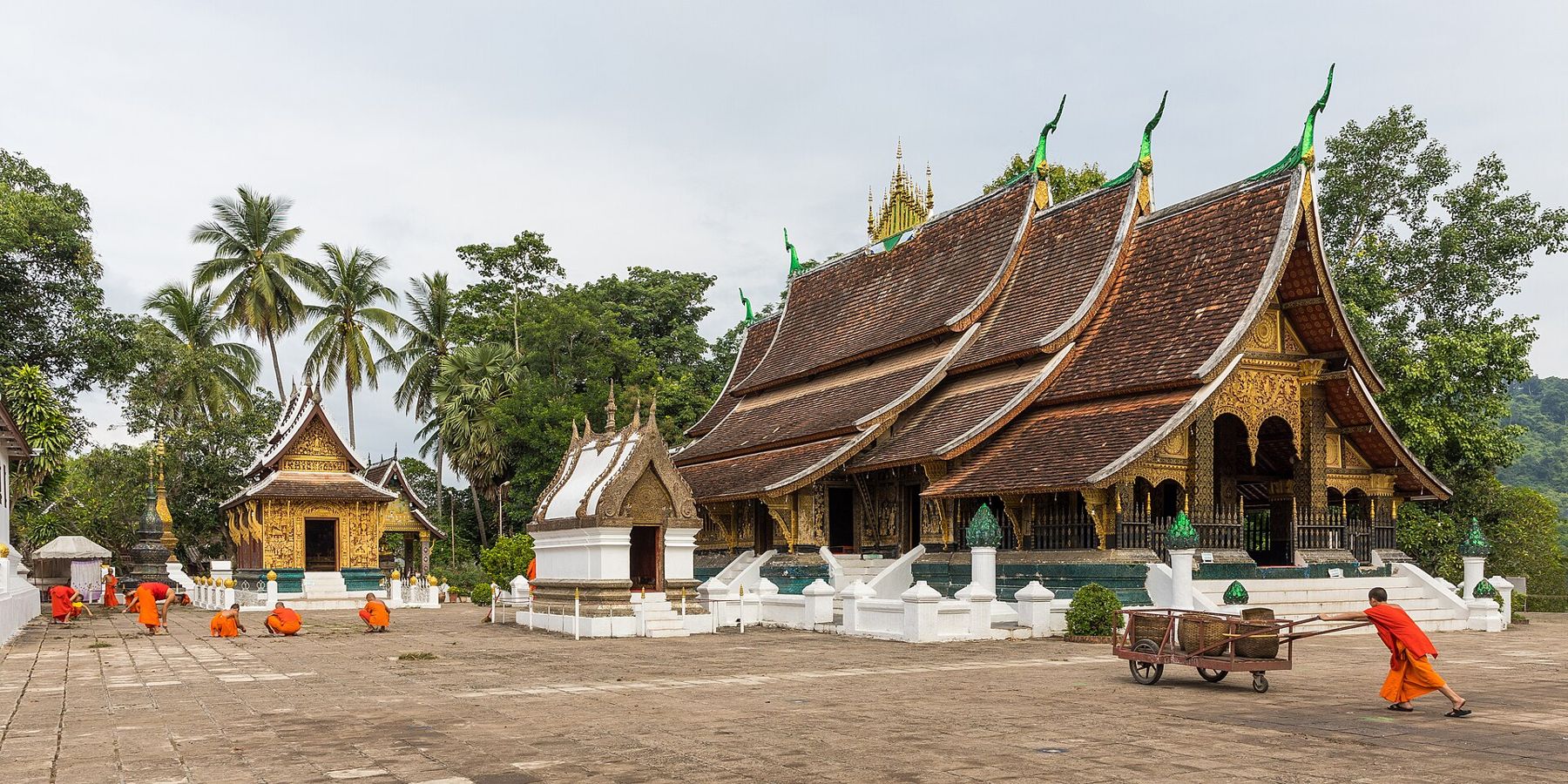
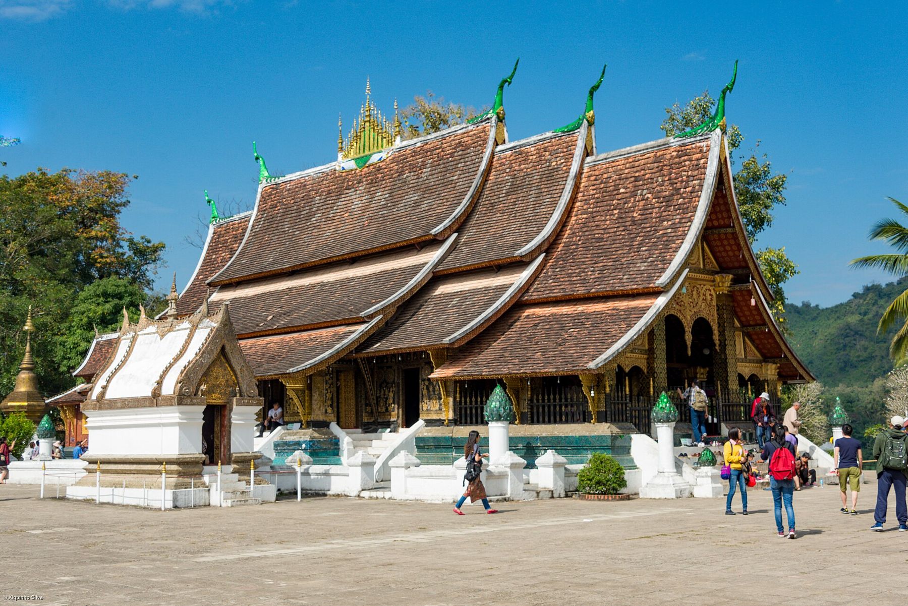
Start at the far end of the peninsula, at Wat Xieng Thong, the most important temple in the town. It was built in the mid-sixteenth century, and its main hall, the sim, has the classic Luang Prabang roof: tiers sweeping down almost to the ground, like the wings of a bird settling. On the rear wall, a mosaic of coloured glass shows a great tree, often called the tree of life, set against a dark red background.
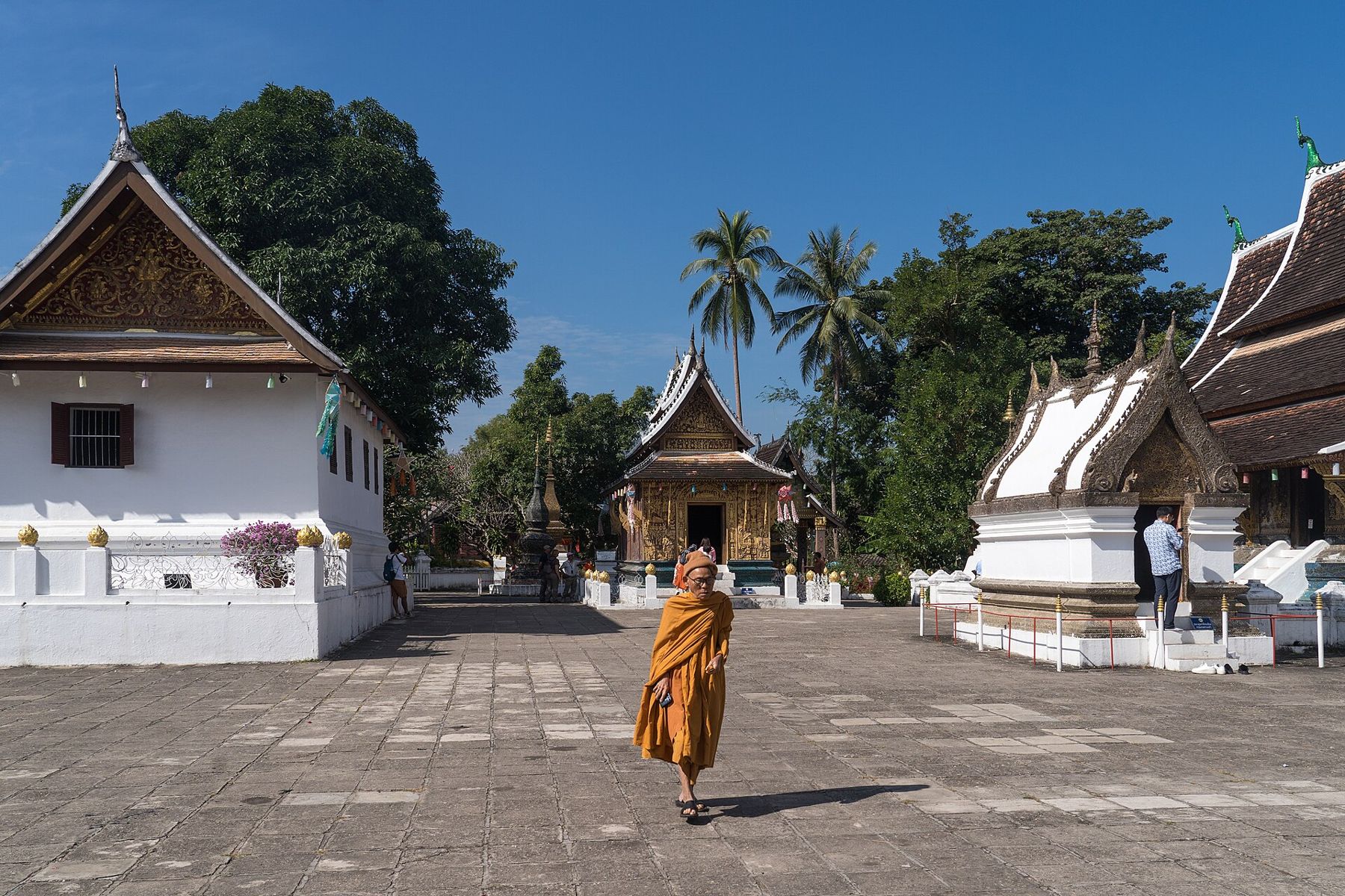
Smaller buildings in the compound hold a royal funeral carriage and Buddha images, and the walls of some chapels are covered in glass mosaics showing village life and scenes from Buddhist stories. Arrive early, when the monks are sweeping the courtyards and the light is soft. Visitors pay a small entry fee.
From Wat Xieng Thong, walk back along Sakkaline Road, the main street running down the spine of the peninsula. Further on it becomes Sisavangvong Road. The street is lined with temples, old houses and shops, and the gardens of the monasteries spill out onto it.
The houses are a mixture of styles. Traditional Lao houses are built of wood on stilts, with shuttered windows and steep roofs. The French villas, built in the early twentieth century, are of brick and plaster, with wooden balconies, tall shutters and tiled roofs, adapted to the climate with deep verandas. Many have been restored as guesthouses and cafes, but the street keeps a quiet, low-rise character.
i
The royal palace
Halfway along the main street, the former royal palace stands in a garden facing the Mekong. It was built in the early twentieth century for the king and his family, and after the monarchy was abolished in 1975 it became a museum. Inside are the throne room with its glittering mosaic walls, royal apartments and gifts from foreign governments. In the grounds, an ornate temple houses the Phra Bang, the revered Buddha image that gives the town its name.
Visitors must dress modestly, with shoulders and knees covered, and leave bags and shoes at the entrance. Photography is not allowed inside the main building.
Fold over to A3Vientiane's quiet centre, That Dam to the Mekong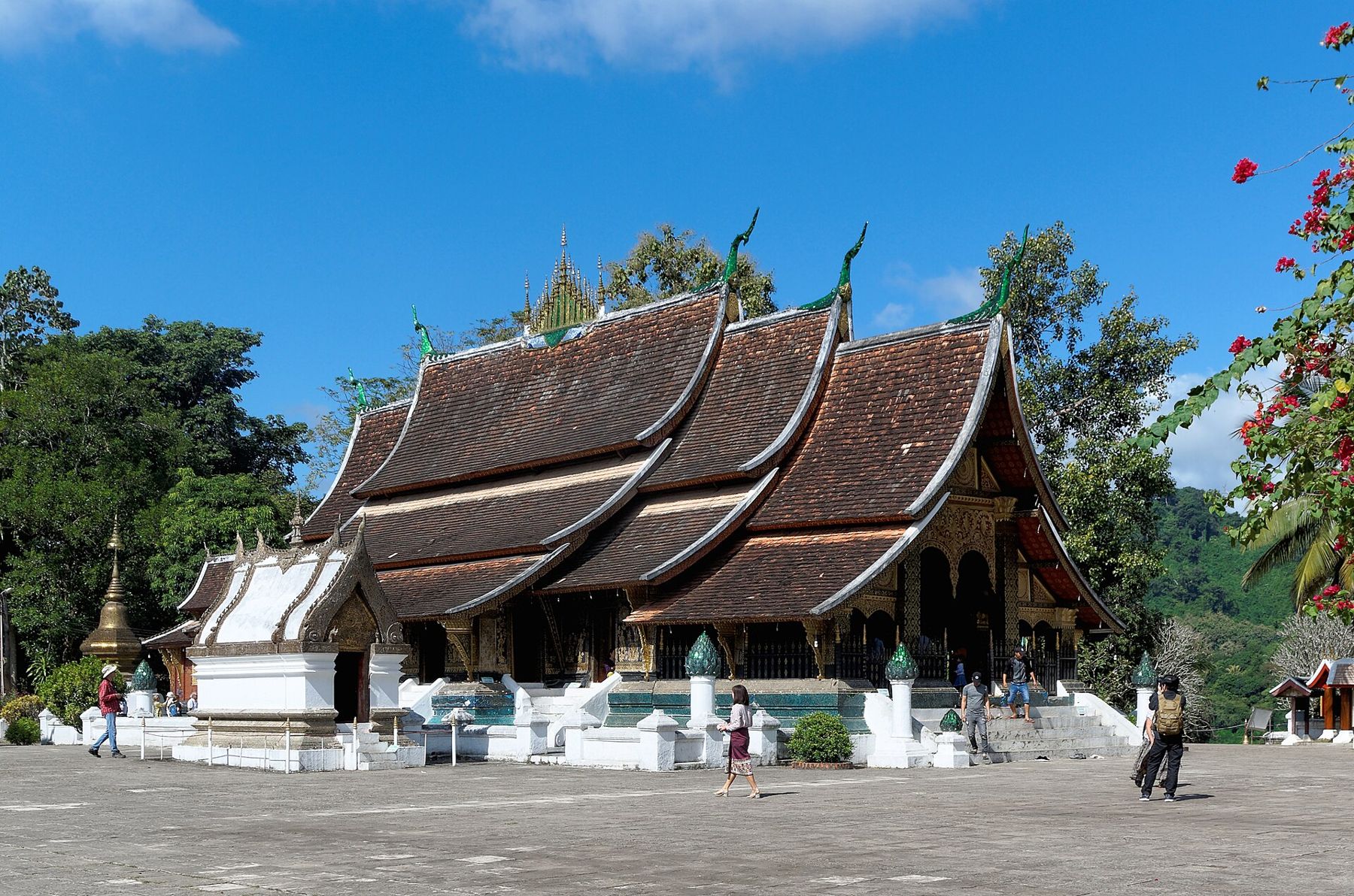
i
Mount Phousi at the end of the day
Opposite the palace, a stairway climbs Mount Phousi, the small hill at the centre of the old town. It is about a hundred metres high and reached by more than three hundred steps. At the top, a gilded stupa, That Chomsi, looks out over the town, the two rivers and the green hills beyond.
Sunset is the most popular time to climb, and the summit can be crowded with people waiting for the light. For a quieter visit, come at dawn, or come down before sunset and watch from the riverbank. Smaller shrines and Buddha images line the paths down the other side of the hill, including a footprint said to be the Buddha's, and a cave shrine half-way down. The eastern stairway leads down towards the Nam Khan, which makes a good link to the next part of the walk.
Both rivers have paths along their banks. On the Mekong side, the riverfront road looks across the wide brown water to forested hills, with long boats moored below. On the Nam Khan side, the river is smaller and clearer, and in the dry season, roughly from November to May, local families build bamboo bridges across it. They are rebuilt each year after the floods wash them away, and a small toll is charged to cross. The bridges lead to villages and gardens on the far bank.
i
Markets, crafts and evening on the main street
Early in the morning, a small market sets up in the lanes near the palace, selling vegetables, river fish, herbs and forest produce brought in from the surrounding villages. It is a working market for residents, busy and lively for a couple of hours after dawn, and a good place to see the food of northern Laos.
In the evening, the main street is closed to traffic and a long night market fills it with stalls under red and blue awnings, selling textiles, paper lanterns, silver and wood carvings. Many of the textiles are woven in villages around the town, and the quality varies widely; the better pieces are usually in the workshops and galleries of the old town rather than on the stalls.
The morning alms round
Each morning at dawn, monks from the temples walk in single file through the streets, carrying alms bowls, and residents kneel by the roadside to offer sticky rice. This ritual, called tak bat, is a religious practice, not a show. In recent years, crowds of visitors and tour groups have disturbed it, with flash photography and people blocking the monks' path.
If you watch, do so from a distance, on the opposite side of the street. Stay quiet, do not use flash, and never stand in the monks' way or touch them. Dress modestly. Only take part in the offering if it means something to you, and if you do, buy rice from a proper source, not from vendors selling it on the spot to visitors.
This ritual, called tak bat, is a religious practice, not a show.
i
The long road north to Vigan
Luang Prabang has an airport with flights from regional hubs, and the Laos–China railway connects it with Vientiane in a couple of hours. Slow boats also come down the Mekong from the Thai border, a journey of two days. The best months are November to February, when the weather is dry and relatively cool. From March, temperatures climb, and smoke from burning fields often fills the valley until the rains arrive. Opening hours and entry fees change, so check them for Luang Prabang before you go. For another old royal centre on the river, see Bangkok's Rattanakosin island.